Feeds:
Posts
Comments
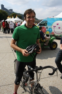
That's me at the end of the DC2PGH ride.

That's me at the end of the DC2PGH ride happy to be home!

I’ve had a couple days to decompress from this whirlwind trip from DC to Pittsburgh. I’ve caught up on my e-mail and wrote a sweet wrap up of the entire trip for my magazine Pittsburgh TEQ. (I’ll post it once it’s published in November.) Reviewing my blog for the TEQ article helped put the whole thing in perspective. So did a few frosty pints and some hotdogs at D’s when I got back that afternoon!

It boils down to a couple of things. Maybe more.

I had a once-in-a-lifetime opportunity to get paid to ride my bike while touting my second passion — Pittsburgh’s tech community– all along the way. The technologies I showcased were pretty awesome. Folks couldn’t get enough of my SenseWear Armband counting calories or watching me take Gigapan pictures. Others were surprised that my Cannondale came from Bedford, Pa., and that the Transitionslenses in my glasses were developed at PPG. Even more were stoked at my remote podcasts via TalkShoe.

Most of all, this trip really drilled in my head how much I love cycling. I’ve always been a bike snob and that will never change. The trip softened my snobbish exterior of high-end bikes, fancy parts and gear, fast average speed and a sprint to the finish. After a few days, I was concerned about having bacon three times a day and soaking in the beautiful scenery. On the section from Cumberland to Confluence, I was in bad shape. Blasted by a cold and driving wind, my snobby side would have me riding in the drops gritting it out to the finish. This time, I stopped for pizza! And pumpkin-shaped cookies. I talked with some other riders and Rockwoood locals. That’s a seachange for me! Relaxing while riding my bike? Who knew?

Better yet, this trip made me realize just how stunning our region is. There’s so many places like Rockwood to explore. Lots of pizzas to eat. I’m considering touring bikes for my wife and me, so we can load up and explore all the great trails in SWPA. I’m not worried about how fast we’ll go, what kind of parts are on my bike, etc. I’m just going to pedal and soak it all in.

I encourage everyone to do the same! Check out the friendly folks at Venture Outdoors. They can help ya.
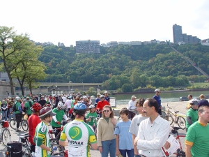
Folks mulling about the finish of the ride from DC to Pittsburgh.

Folks mulling about the finish of the ride from DC to Pittsburgh.

Distance: 37 free-flowin’ miles

Calories burned: who cares?

Ride time: Never really checked it today!

I can’t believe the DC2PGH ride is done. I logged more than 350 miles in a week. My legs are a little sore and I’m a bit tired as I make this quick post. Last night was an absolute nightmare staying in a “cozy” little “motel” near Smithton. I was never so happy to get back to camp and ride the final leg of the Tour into Pittsburgh.


I had the absolute pleasure of riding with PA Senator John Pippy. What a nice, energetic guy. He clipped right alongside us as we cruised into McKeesport before having lunch and some official ceremonies to launch us to Point State Park. John is planning on attacking the same ride we did next week. He’s going to blog about it, too. I’ll post a link to it, once it’s ready to go. He’ll crush it for sure.

Today’s ride was a super easy pace into the city. Just tried to soak it all up before the journey came to an end. It got dicey as a hundreds of cyclists made their way in to the city. It was great to see support of the ride.


I have all of my pics uploaded in Flickr. Check ’em out to the right of the page. I’ll have a wrap up post shortly to put a bow on this. What a great time we all had. Our region is blessed with such an excellent  asset.


Get out there and ride!

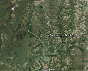
Ariel view of Confluence by Google Earth.

Ariel view of Confluence by Google Earth.

Trip: Cumberland, MD to Confluence, PA


Distance: 62 Frozen Miles

Riding Time: 4:30 hours

Trip time: 6 hours

Calories burned: 1,200


If you read the last blog entry, I reported my happiness returning to the civilization of Cumberland. Yes all it takes for civilization is a bike wash, strawberry shakes, a Holiday Inn, Wi-Fi and $3.50 pints of Guinness. Nothing more, nothing less.


I was sorta sad to leave my little paradise realizing the wilderness lay just at the top of a 20-mile, 1,600-ft. climb to Frostburg. After that you can kiss cell phone coverage goodbye.


Geoff and started out at a brisk, yet easy spin up the Big Savage climb averaging 13 mph. I could feel the night at Reds Bar catching up to me slowly, but surely. Soon enough we summited and crossed the Mason Dixon Line. I was now starting to long for home. However, reality set in quick as the summit brought on brisk winds and dropping temps. Rolling through the Big Savage Tunnel chilled me to the bone. I came to this gunfight with a squirt gun as I only brought a long-sleeve jersey and a rain jacket. My hands and knees froze on the long descent toward Rockwood, PA.


Ahh Rockwood. Home of all things good. Mainly pizza and homemade cookies. We rolled into Sweet Treats. I opened the door to a warm bake shop and pizza oven in the back. I was saved. I ordered a pepperoni pizza and warmed up by the oven. Pizza never felt so good.


Fueled up with hot pie and pumpkin-shaped cookies with bright orange frosting (they’re making ghost cookies next week), Geoff and I saddled up and prepared for the last 20 miles of scenic bridges and the Casselman River. Eye-popping stuff. Especially as the leaves were starting to change.


I lead a 21 mph pull for three miles to finish off the ride into Confluence. When I arrived at the Riverest B&B, I was greeted by a couple, June and Dave, who wanted to learn more about the technologies that I’m showcasing. I gave an hour-long demo of my gear and they were quite impressed. I have an open invite for a stay the next time that I’m in Confluence. Man, I’ve met some really nice people along the way.


We’re getting close to wrapping the trip up. Only two days left.

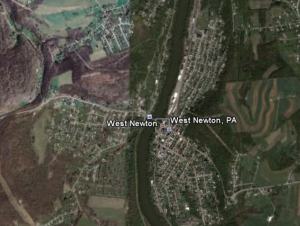
Ariel view of West Newton compliments of Google Earth.

Ariel view of West Newton compliments of Google Earth.

Mileage: 52 serene ones

Calories burened: 1,050

Ride time: 3:30

Trip Time: 4:00


I’ve gotta keep this post sort of short as my battery is dying and I can’t find a power outlet around the West Newton Community Pool. Everyone around camp is feeling pretty optimistic as we enter the last segment of the 250 Tour.

We’ve covered about 300 miles and we’re all missing home. Todaywas a great day to spin 52 miles through Ohiopyle and down into West Newton. The trail through Ohiopyle has breath-taking views of the Yough river. I kept a brisk pace into Connellsville and stopped for a bit to see where General Braddock crossed the Yough to fuel up before his last march toward Fort Duquesne during the French and Indian War. I’m a sucker for history and I soaked up the scene.

Geoff caught back up to me and we kept the pace rolling at 21-22 mph for about 6 miles. It felt sort of pointless so we tamed it down and kept ticking off the miles to camp. Cedar Creek Park looks like an excellent place to hike and enjoy the Yough. be sure to check it out.

I’m pretty excited to roll into Pittsburgh. State Sen John Pippy is joining me for the last leg of the ride. It’s great that elected officials see the benfit of this awesome trail system.

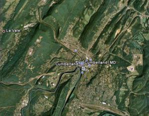
Google Earth view of Cumberland, MD.

Google Earth view of Cumberland, MD.

On paper what looks like a miserable day in the saddle turned out to be the highlight of the trip so far. I ate a light breakfast as I have turned into the freaking “baconator” over the last couple of days ingesting at least two pounds of the greasy crap. When you’re burning 5,000 calories a day as the Body Media SenseWear Armband has been reporting, I haven’t cared too much. But let’s just say enough is enough.


Geoff and I departed camp paying a quick homage to Bill’s Beer Tavern (still not sure of the real name) with a salute. We weren’t on the trail more than 15 minutes before we found ourselves in a paceline with a couple riding a tandem. We were going full-tilt down the bumpy C&O at 20 mph. We were a freight train of clacking gears. The effort lasted about 3 miles before the tandem dropped out. Before we knew it, we made it to the Paw Paw Tunnel with a light drizzle tinkling on our helmets. We snapped a few pictures and marveled at the 6 million bricks lining the 3,000 foot long tunnel. Riding through it felt like a Kennywood ride. I was a little freaked out as the the path is about 4 feet wide with a flimsy wooden handrails and the walls arched close by overhead. Once you get your bearing, it became pretty interesting and we popped out the other side in no time.


That’s when the fun began. The rain starting driving into us with authority — pelting us, but beading up off my Cannondale rain jacket. My X4 cyclocross bike laughed and gave the sky the finger as I found my wicked 46X18 gear combo and the 25 mile pull to Cumberland started.


Geoff and I navigated some of the nastiest trail conditions imaginable. Even the potholes had potholes. The faster we pedaled the trail seemed to even out. We beat the refreshment vehicle that was to meet everyone at Old Town. I fired back three chocolate covered donuts stashed in my bag and Geoff scarfed a granola bar. I turned on the Hold Steady’s “Stay Positive” and made it into Cumberland averaging just about 16 mph all the way.


I’ve never been so happy to see civilization! The local bike shop Cumberland Trail Connections hooked us up with a sweet bike wash and Wendy’s offered  a spicy chicken sandwich. Made it over to the Queen City Creamery for frosty strawberry shakes. Better yet, I have blazing-fast connectivity, so I’m catching up on posting photos and my podcast.

What a great day. My equipment was flawless. My PPG Transition lenses kept the glare and rain from being an issue. I did a Talkshoe podcast today with the greatest of ease. Who can complain

Tomorrow, we climb Great Savage and start tour decent into PA!

Ariel shot of Little Orleans. Where is Bill's?

Ariel shot of Little Orleans. Where is Bill's?

I gotta start off with a quick note that I’m having severe connectivity issues. I’m talking 5 minutes to open a web page! An hour to upload three pictures! Pics and podcasting are impossible for the time being. I’m quite frustrated. I’ll post once I can. Please bear with me as this has become a true experiment in space, time and frustration.


Now that I have that out of the way, today was a spindly little ride of 30 flat, smooth miles from Fort Frederick to Little Orleans, home of Bill’s Tavern and Bait Shop. I can’t wait to post pics of the place. Absolutely stunning. $2 beer and gravy fries. Bait is $2.50. Too cool. Bill’s daughter actually recognized me from some local media coverage we received earlier this week. I was that “tech guy from Pittsburgh.” I tried leveraging that into a free beer. No luck.


Today is a building day to get to the bigger legs of this tour. Tomorrow is 50 and we’ll roll through the Paw Paw Tunnel — almost 1/2 mile long with 6 million bricks. We tooled an easy 15 mph pace interjected with French toast, Snickers bars and chocolate-covered donuts in Hancock. Washed it back with a few $2 Yuenglings at Bill’s. I’m slowly starting to learn to slow down and chill out. Average speed is starting to change to average burrito and bacon consumption.


The two-hour spin over was a great way to keep the legs fresh before we tackle three, 50-plus mile legs. Keep coming back. Hopefully connectivity will improve and you can share in my ride with a bit more detail.

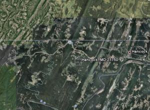
Ariel View of Fort Frederick and Hancock, MD, via Google Earth.

Ariel View of Fort Frederick and Hancock, MD, via Google Earth.

Miles: 50 Fun ones

Calories burned: 650, total for the day 4,400

Wow! What a fun day in the saddle. We rode through Antietam Battle Field on our way over to Fort Frederick. We started out with a chilly, crisp breeze and an easy spin for 12 miles to the Antietam Battle Field. We took a tour and watched a movie and it was incredible to see the site of the “bloodiest day” in American history. The scene was absolutely awe inspiring. The beauty of rolling farmland and rugged mountains is immediately interrupted as you enter the visitor’s center and are confronted with a 8-ft tall picture of dead bodies heaped in front of Dunkers Church hours after the battle on Sept. 17 1862. Just knowing so much blood was shed on this serene setting put a lot of things in perspective for me. I have no real problems.

Geoff and I rode through the battle fields. And rode over Burnsides Bridge. More people need to see sites like these. It makes you appreciate the life and liberty you have. Enough said!

We rolled back down to the C&O Canal and Geoff only flatted out once! Locals offered help and gave us a few apples. Pretty sweet eating on the way back. I typically only like apples in pie format, but I had to indulge myself with this. We turned up the heat and averaged about 17 mph for the last 12 miles to arrive at Fort Frederick. We broke 20 mph for the last two iles just to drive a stake in the ride. Smiles abounded! I can’t believe how much fun I’m having. I even managed a podcast done remotely from the campground! It should be posted shortly! All the gear is working great. The Canary suffered a horrible shaking and is not working too well.


Look for pics soon. I’ll post once I’m in Hancock later tonite. Lots of great pics from Antietam. Off to shoot a Gigapan of Fort Frederick shortly!


Almost forgot, today we celebrated Rosh Hashanah! We shared Mandel bread and sponge cake around the campsite! Can’t get pics as the camera died.  Thanks for the good stuff, Audrey:-)

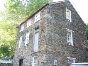
Some old house in Harpers Ferry. Ain't she purty?

Some old house in Harpers Ferry. Ain't she purty?

Trip: Rockwood Manor to Harpers Ferry, WVA


Distance: 50 Muddy Miles

Riding Time: 4 hours

Trip time: 5.5 hours

Calories burned: 600, 4,600 for the day

Pollution Index: 17


You may have noticed that I stated 50 Muddy miles in the distance log. We rolled out of Rockwood Manor (about 12 miles outside Georgetown) with threatening skies, jungle-like humidity and miles of muddy canal towpath to come!


For sure, today was a not ride for the beginner or the weak of heart. Mile upon mile of towpath was just littered with puddles and soft soil. My approach to survive was to go into my full cyclocross mode. I averaged 18-20 mph for about 10 miles, cutting a line right down the middle. Wow, what fun. I was soaked and covered in sandy mud. I felt like a kid having a ball. My bike was a razor tearing through the towpath. No worries. The Cannondale X4 was made for nasty conditions and this was as nasty as it gets. I’m so happy that I mounted some SKS fenders. Kept the slop off my back side.


Geoff and I ran into a few issues with flat tires. Geoff has a history of flats on epic rides for some reason and this day proved no different. He flatted out four time before the half-way mark at Whites Ferry. It took three shots to get the microscopic piece of shrapnel out of his tire! I froze my index finger to the to the CO2 inflator and tore some skin off. Ouch!


 Geoff was pretty disgusted just before we magde the half-way point. Changing a muddy flat with mosquitos biting you is not fun. About a mile down the trail, we ate lunch and filled up our water bottles. A handful of Skittles alleviated our frustration.


After finishing up lunch and crossing a road to get back on the towpath, the trail changed like you’d never believe. There was hardly a puddle in sight. Smooth double track meandered along the deteriorating canal. Trees hung and swayed like old men with lots of stories to tell. It really became beautiful and the areas souther charm started to warm our hearts. We slowed our pace to 14-15 mph and enjoyed the rythm of our bikes crunching under the drying mud. We talked to a few riders along the way and before we knew it, we were crossing an old railroad trestle into Harpers Ferry. Felt like I stepped back into the Civil War. What an amazing and beautiful old town. Tomorrow we’re off to see Antietam.


Small side note. I couldn’t take pictures during the ride as I feared the impending downpour would ruin my camera. I took a bunch of pics in Harpers Ferry. I posted one. Upload times are insane here as Internet access is painfully slow.


I did whip out the Gigapan camera and took a bunch of shots of the Potomac an Shenandoah rivers converging. I will upload them at the end of the trip!


Podcasts coming soon, too. Logistics are killing me!


Day one of our 335-mile journey started in Georgetown and went a whopping 12 miles to Rockwood Manor. I actually rode 16 miles as my riding buddy — Geoff Tolley — and I missed a key detour somewhere and took a more scenic route. We stopped by Great Falls a day early. Check out the pics on our Flickr list to the right.


The scenery and terrain are beautiful. The C&O canal was/is an engineering marvel. Hard to believe it was handmade nearly two centuries ago. The locks are truly magnificent.


After threatening rainstorms, extreme humidity and lots of gritty mud, we made it to our destination, ready for dinner. It was great having a short start. It allowed us to get our bearings together and figure out logistics.


Thank the good Lord for hotels. As I type this blog, the room is cool and the beer colder! I’m looking forward to 50 miles tomorrow to Hapers Ferry. We’re expecting a few showers. The Cannondale X4 cuts through the mud and grime like the proverbial hot knife through butter. Fantastic bike for this tour.


My BodyMedia SenseWear shows me knocking off 3,800 calories today. I burned about 200 riding. I look forward to providing a podcast tomorrow and more detail as we officially get some real time in the saddle.


The SUO-200M USB Multi-Cable will simplify the management of my electronic devices on the DC2PGH ride.

I’m going to powering up a number of devices during the week-long, 335-mile ride from DC to Pittsburgh next week. I’ve got a couple cameras, my GPS, an iPOD, cellphone and lots more. The folks at Sima, a cool Council member company and innovator of electronic products and devices, is letting my use its SUO-200M multi-cable device.

Sima’s patent-pending USB Multi Cable with Firewire is the solution for powering or connecting
different devices via USB or Firewire with a single, versatile cable. While traveling on business or pleasure, take only one cable with multiple USB and Firewire connectors to charge or connect. You can use the USB Multi FireWire with most major name brand digital camcorders, digital cameras, media players, cell
phones, laptops, portable DVD players, PDAs and more.